
Generating Contours using Google Earth
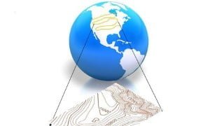

Learn how to generate contours for engineering designs without visiting the site. This course teaches surveyors, engineers, and architects how to use Google Earth to extract 3D data and convert it into contours. Discover the uses of contours in various infrastructure projects like roads, railways, and water supply systems. With detailed lessons on contour characteristics and drawing techniques, this course offers a cost-effective solution for preliminary planning. Improve your design accuracy and reduce expenses by enrolling in this course today. Suitable for surveyors, civil engineers, and architects.
What you’ll learn
- Generating contours for Engineering Designs
Without visiting site, you can generate contours for preliminary designs before actual survey done and even the actual survey can be planned with less expense. Though the accuracy level of contour may be low, it depends on the accuracy of 3D data in Google Earth. At many instances it has been observed the difference in height in Google earth and actual MSL varies between 3 to 1 meter. Sometimes it may be very high.
The benefit of this course is – preliminary planning of any infra projects like Roads, Railways, water ways like canal network, water supply projects, power transmission lines needs contours for designing.
Surveyors, Engineers and Architects can take this course and learn to use this great tool.
Lesson 1 explains about what is contour and how it is drawn in detailed manner..
Lesson 2 explains about Characteristics of contour , how contours represented in hill , valley , plain area and saddle .in detailed manner.
Lesson 3 explains about uses of contour and in which projects contours can be used in detailed manner..
Lesson 4 explains how to download Google earth and how to extract 3D data from Google earth, how to convert 3D data in to KML file in detailed manner. .
Lesson 5 explains how to convert 3D data in to contours and label it using QGIS in detailed manner.
Lesson 6 explains how manually contours can be drawn on Google earth.
Who this course is for:
- Surveyors, Civil Engineers and Architects
User Reviews
Be the first to review “Generating Contours using Google Earth”
You must be logged in to post a review.





There are no reviews yet.