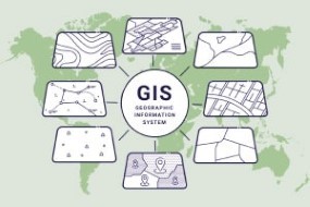
Geographic Information Systems
Learn about geographic information systems, how to represent data in the real world, how you can use GIS to achieve this, and the global positioning systems.
This free online course will help you understand the concept of geographic information systems. You will learn about how to represent data in the real world, and how we can use GIS to achieve this. You will be informed on how data flows, the different databases, models, and the various opportunities available in the GIS field. You will also learn the various analyses that can be done on data collected and the software used in mastering GIS tools.
What You Will Learn In This Free Course
Introduction to Geographical Information System
This module discusses aspects of geographic information, geographic information technologies, remote sensing, and spatial analysis. You will learn about geographic information science, spatial data, attribute data, the disciplines contributing to GIS, and the applications of GIS. You will also learn about the origins of GIS, GIS capabilities, spatial data acquisition; data investigation, and software integration.
Representing a Real World in Digital Scape
In this module, you will learn about representing the real-world on a digital scale. You will be introduced to how to convert real-world data into a digital real-world model, and the principles of the real-world model. You will also learn about entities in the real-world model, attributes, and relationships.
Data Types and Data Models
This module discusses what data is, the kind of data that can be handled by GIS, the different data models, and examples of data models. You will learn about the vector data model, the two types of vector data models which are the spaghetti data model and the topological data model. You will also learn about representing the real world in the surface model.
Querying, Georeferencing and Map Projections
This module discusses how to do georeferencing, the kinds of different systems there are, and different projections. You will learn about geoid, what kind of geoid is there, and how we look at the geoid as a reference point. You will then learn about datums, how we look at datums, and certain coordinate systems.
GIS Data Quality
This module explores data quality, the different data measures, data assessment techniques, and errors that they may have. You will learn about the aspects considered for data accuracy, the factors affecting spatial data quality, and the sources of error in spatial data. You will also learn about map display and visualization in GIS.
Global Positioning System
This module explores the global positioning system. You will learn about the history of the global positioning system, the working principles, GPS satellite signals, and errors in GPS. You will also learn about the global navigation satellite system and an introduction to QGIS.
Diploma in Advanced Geographic Information Systems – First Assessment
You need to score 80% or more to pass this assessment.; Module
Introduction to Database and Database Management System
This module discusses the meaning of a database and database management system. You will learn about how to store data, how to retrieve data, And most importantly, the different ways of storing data in the different databases that are available. You will also learn about the languages that are being used in order to manage this database or query data from the database.
Database Query and Spatial Analysis
This module discusses how to create, maintain, edit, and how well you can use a database. You will learn about the different types of databases, how the querying can be done, and how to address certain issues when creating a database. You will also learn about the structured query language, spatial analysis, and basic editing.
Basic and Advanced Spatial Analysis of Data
This module explores remote sensing in GIS, spatial analysis, the basic spatial analysis with examples, and also advanced spatial analysis with some examples. You will learn about the limitations of having a geographical information system in place, and a formal problem in establishing GIS.
Introduction to QGIS and Data Import
This module discusses the interface of QGIS, importing vector data, tabular data, and raster data into the QGIS interface. You will learn about the properties, identification of features; the attribute table followed by metadata inspection and properties viewing.
Data Generation and Analysis using Various Sources
This module explores where to get the raster data from. You will learn how to download raster data, how to perform terrain analysis; such as slope, aspect, hill shade, and contour. You will also learn how a raster calculator works and QGIS, which has an inbuilt raster calculator function.
Open Source GIS Software and Geoserver
This module explores how well open-source software is designed and how it actually compares with proprietary software. You will understand how an open-source standard is being built and how India is actually becoming a greater game. You will gain more understanding of the open-source software and how you can use it.
Advanced Diploma in Geographic Information Systems – Second Assessment
You need to score 80% or more to pass this assessment.; Module
Course assessment
User Reviews
Be the first to review “Geographic Information Systems”
You must be logged in to post a review.


There are no reviews yet.