How to Protect Heritage Sites Remotely – Archaeology Course
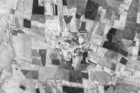
Learn how to use satellite imagery to identify and assess archaeological sites in the Middle East and North Africa with this course from Durham University.
Who is the course for?
This course is designed for anyone interested in archaeology and using remote sensing.
It will be particularly useful for heritage professionals working in countries in Middle East and North Africa (MENA) countries.
What topics will you cover?
Using satellite imagery for archaeology
Seeing archaeology
Seeing damage
Landscapes of mud
Landscapes of stone
Communicating information: making maps
What will you achieve?
By the end of the course, you‘ll be able to…
Perform basic remote sensing tasks with free satellite imaging platforms such as Google Earth Pro
Identify basic archaeological processes that influence site formation
Identify a range of archaeological sites through satellite imagery
Assess threats and damages to heritage sites using remote sensing techniques
Create maps using Google Earth Pro
User Reviews
Be the first to review “How to Protect Heritage Sites Remotely – Archaeology Course”
You must be logged in to post a review.


There are no reviews yet.