
Geography
Geography courses explore the physical features of the Earth and the human societies that inhabit it, analyzing the complex interactions between people and their environments to understand global patterns.
Read More
- Key Skills:
- GIS mapping, spatial analysis, remote sensing, environmental impact assessment, urban planning, cartography, demographic analysis, data visualization.
- Typical Duration:
- Most courses take 10–40 hours; some take 40+ hours.
- Top Providers:
- SWAYAM, MIT OpenCourseWare, Saylor Academy
Mapping the Human and Physical World
Geography courses provide a rigorous intellectual toolkit for understanding the “where” and “why” of our world. Unlike simple memorization of capitals, modern geography is an analytical science that bridges the gap between the natural and social worlds. You will distinguish between the two main pillars: “Physical Geography,” which studies natural processes like climate patterns and landforms, and “Human Geography,” which analyzes cultures, economies, and migration. The curriculum centers on “Spatial Analysis,” teaching you to see patterns in data—such as disease outbreaks or urban sprawl—that are invisible without a geographic lens.
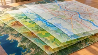
Advanced professional learning modules engage with the technological revolution of “Geographic Information Systems” (GIS). Students explore how to layer complex datasets onto digital maps to solve problems ranging from disaster relief logistics to retail location planning. You will also grapple with “Geopolitics,” understanding how physical terrain influences international relations and conflict. A key real-world use case involves a geographer using remote sensing to track deforestation in real-time, or an urban planner designing a transit system based on commuter demographics. Graduates frequently pursue diverse job pathways as GIS analysts, environmental consultants, town planners, or emergency management coordinators, serving as the spatial architects of a connected planet.
Who Should Enroll?
- Urban Planners: Professionals needing to understand the spatial logic of cities to design sustainable and efficient communities.
- Environmental Consultants: Specialists seeking to map natural resources and assess the physical impact of development projects.
- GIS Analysts: Data scientists looking to specialize in the “locational intelligence” that powers modern logistics and navigation apps.
- Government Officials: Policy makers responsible for managing land use, zoning laws, and disaster response strategies.
- Educators: Teachers wanting to go beyond the map to explain the complex systems that shape global cultures and climates.
Enroll in a Geography course today to master the science of place, gaining the analytical expertise to map the future and navigate a changing world.
Showing all 3 resultsSorted by latest

Frequently Asked Questions about Geography Courses
1. What is the difference between Physical and Human Geography?
Physical Geography studies the natural environment, including landforms, climates, and ecosystems (like a scientist). Human Geography studies human culture, economy, and society (like a sociologist). Most geography courses cover both to show how the physical world shapes human behavior and vice versa.
2. Is Geography just about memorizing maps?
No, professional geography is about analyzing maps and spatial data, not memorizing them. It focuses on “Spatial Reasoning”—understanding why things are where they are. You learn to interpret complex patterns of migration, trade, and climate rather than just locating countries on a globe.
3. What is GIS and why is it essential?
GIS (Geographic Information Systems) is software used to capture, store, and analyze spatial data. It is the primary tool of modern geographers. You learn to layer different types of data (like roads, population density, and flood zones) to solve complex problems, making it a highly employable technical skill.
4. Can I work in tech with a geography background?
Yes, “Location Intelligence” is a massive sector in tech. Companies like Google, Uber, and Amazon hire geographers to improve mapping services, optimize delivery routes, and analyze user location data. A background in geography combined with coding skills is a powerful entry point into the tech industry.
5. How does geography address climate change?
Geography is at the forefront of climate change research. Physical geographers study the mechanisms of climate patterns (climatology), while human geographers study the social impact of rising sea levels and migration. Courses integrate these perspectives to propose holistic adaptation strategies.
6. What is “Remote Sensing”?
Remote Sensing involves collecting data about the Earth from a distance, usually via satellites or drones. Geographers use this to monitor deforestation, track urban growth, and measure crop health without visiting the site. You learn to interpret satellite imagery to extract actionable environmental data.
7. Is fieldwork required for these courses?
For a full degree, fieldwork is a standard requirement to learn data collection techniques like surveying. However, many online courses use “Virtual Fieldwork,” allowing you to explore landscapes and collect data digitally using Google Earth and other simulation tools.
8. What is “Geopolitics”?
Geopolitics is the study of how geography influences politics and international relations. You analyze how natural resources (like oil or water) and physical borders shape conflict and cooperation between nations. It is essential for understanding global news and diplomatic strategy.
9. Can I become a town planner with this degree?
Yes, Geography is a traditional pathway into Urban and Regional Planning. You learn about land use, zoning, and the social dynamics of cities. While professional planning roles often require a specialized Master’s, geography provides the foundational understanding of how human settlements function.
10. Why is “Cartography” still relevant?
Cartography is the art and science of map-making. In the age of digital data, effective visual communication is more important than ever. You learn design principles to ensure that your maps are not just accurate, but also clear and persuasive tools for storytelling.